
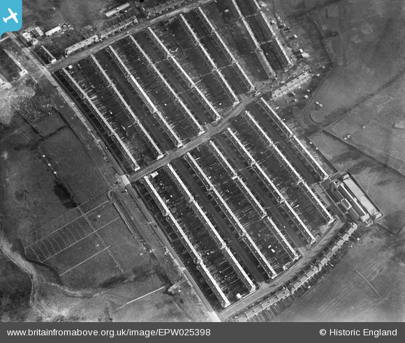
EPW025398 ENGLAND (1928). A new housing estate on the North Circular Road by the Brent Reservoir, Dollis Hill, 1928
© Copyright OpenStreetMap contributors and licensed by the OpenStreetMap Foundation. 2026. Cartography is licensed as CC BY-SA.
Nearby Images (11)
EPW025398

EPW025397

EPW025417

EPW025396

EPW025410

EPW025411

EPW021257

EPW025415

EPW025413

EPW025414

EPW025412

Details
| Title | [EPW025398] A new housing estate on the North Circular Road by the Brent Reservoir, Dollis Hill, 1928 |
| Reference | EPW025398 |
| Date | 9-November-1928 |
| Link | |
| Place name | DOLLIS HILL |
| Parish | |
| District | |
| Country | ENGLAND |
| Easting / Northing | 521739, 186706 |
| Longitude / Latitude | -0.24340431340827, 51.565595315999 |
| National Grid Reference | TQ217867 |
Pins

flyer |
Tuesday 8th of April 2014 12:53:29 PM |