
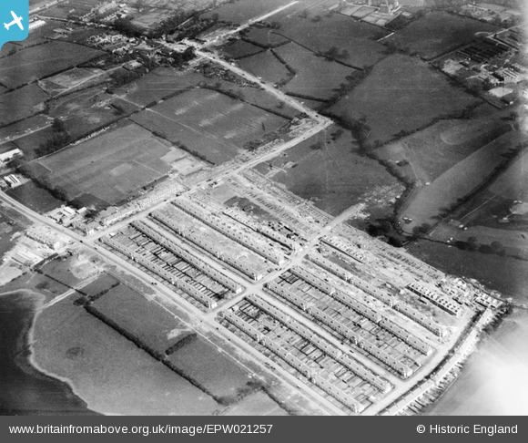
EPW021257 ENGLAND (1928). A housing estate under construction at Heather Road, Dollis Hill, 1928
© Copyright OpenStreetMap contributors and licensed by the OpenStreetMap Foundation. 2026. Cartography is licensed as CC BY-SA.
Nearby Images (13)
EPW021257

EPW025415

EPW025412

EPW025411

EPW025410

EPW025413

EPW025416

EPW025396

EPW025398

EPW025397

EPW025417

EPW025399

EPW025414

Details
| Title | [EPW021257] A housing estate under construction at Heather Road, Dollis Hill, 1928 |
| Reference | EPW021257 |
| Date | May-1928 |
| Link | |
| Place name | DOLLIS HILL |
| Parish | |
| District | |
| Country | ENGLAND |
| Easting / Northing | 521922, 186690 |
| Longitude / Latitude | -0.24077066113878, 51.56541196201 |
| National Grid Reference | TQ219867 |
Pins

Phil |
Monday 20th of April 2015 11:14:39 PM |