
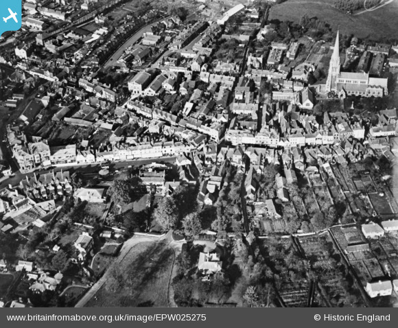
EPW025275 ENGLAND (1928). The town centre, Dorking, 1928. This image has been produced from a copy-negative.
© Copyright OpenStreetMap contributors and licensed by the OpenStreetMap Foundation. 2026. Cartography is licensed as CC BY-SA.
Nearby Images (12)
EPW025275

EPW057020

EPW025274

EAW042716

EPW001616

EPW053878

EAW042713

EPW053877

EPW025273

EAW042715

EPW057017

EPW006291

Details
| Title | [EPW025275] The town centre, Dorking, 1928. This image has been produced from a copy-negative. |
| Reference | EPW025275 |
| Date | October-1928 |
| Link | |
| Place name | DORKING |
| Parish | |
| District | |
| Country | ENGLAND |
| Easting / Northing | 516482, 149337 |
| Longitude / Latitude | -0.33149212416289, 51.230802794463 |
| National Grid Reference | TQ165493 |
