
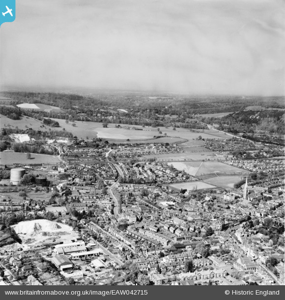
EAW042715 ENGLAND (1952). The town centre, Dorking, from the south, 1952
© Copyright OpenStreetMap contributors and licensed by the OpenStreetMap Foundation. 2026. Cartography is licensed as CC BY-SA.
Nearby Images (7)
EAW042715

EPW001616

EPW025274

EPW025275

EPW057017

EAW042713

EPW053878

Details
| Title | [EAW042715] The town centre, Dorking, from the south, 1952 |
| Reference | EAW042715 |
| Date | 28-April-1952 |
| Link | |
| Place name | DORKING |
| Parish | |
| District | |
| Country | ENGLAND |
| Easting / Northing | 516264, 149423 |
| Longitude / Latitude | -0.33458546367477, 51.231620322647 |
| National Grid Reference | TQ163494 |
Pins

Phillip Taylor |
Thursday 26th of April 2018 12:27:19 PM | |
|
Arthur |
Monday 24th of July 2017 06:36:03 PM | |
|
rog8811 |
Monday 27th of October 2014 06:11:51 PM | |
|
GrahamC |
Tuesday 12th of August 2014 10:15:54 PM | |
|
GrahamC |
Tuesday 12th of August 2014 09:47:14 PM | |
|
GrahamC |
Tuesday 12th of August 2014 09:44:45 PM | |
|
GrahamC |
Tuesday 12th of August 2014 09:42:33 PM | |
|
GrahamC |
Tuesday 12th of August 2014 09:41:06 PM | |
|
cptpies |
Tuesday 6th of May 2014 03:24:33 PM | |
|
cptpies |
Tuesday 6th of May 2014 03:24:13 PM | |
|
cptpies |
Tuesday 6th of May 2014 03:23:18 PM |
User Comment Contributions

Previously unrecorded pimples and blocks close to the rail line, Dorking. |
cptpies |
Tuesday 6th of May 2014 03:31:03 PM |