
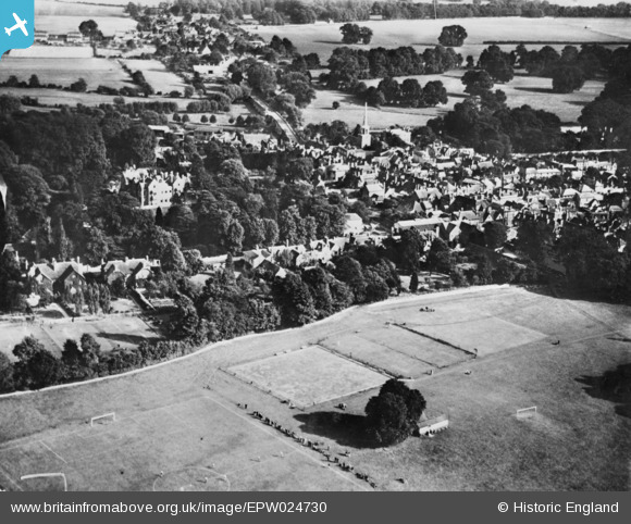
EPW024730 ENGLAND (1928). The Bull Croft and the town, Wallingford, from the north-west, 1928. This image has been produced from a copy-negative.
© Copyright OpenStreetMap contributors and licensed by the OpenStreetMap Foundation. 2026. Cartography is licensed as CC BY-SA.
Nearby Images (6)
EPW024730

EPW024731

EPW000892

EAW046251

EAW046250

EPW000899

Details
| Title | [EPW024730] The Bull Croft and the town, Wallingford, from the north-west, 1928. This image has been produced from a copy-negative. |
| Reference | EPW024730 |
| Date | September-1928 |
| Link | |
| Place name | WALLINGFORD |
| Parish | WALLINGFORD |
| District | |
| Country | ENGLAND |
| Easting / Northing | 460609, 189640 |
| Longitude / Latitude | -1.1247877420183, 51.601863399095 |
| National Grid Reference | SU606896 |
Pins
Be the first to add a comment to this image!