
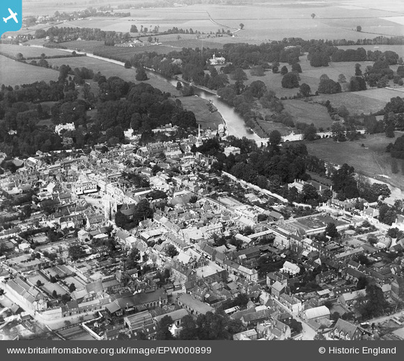
EPW000899 ENGLAND (1920). Wallingford Town Centre, Wallingford, 1920
© Copyright OpenStreetMap contributors and licensed by the OpenStreetMap Foundation. 2026. Cartography is licensed as CC BY-SA.
Nearby Images (10)
EPW000899

EPW000898

EPW000893

EAW046251

EAW046250

EPW000892

EPW024732

EPW024733

EPW024731

EPW024730

Details
| Title | [EPW000899] Wallingford Town Centre, Wallingford, 1920 |
| Reference | EPW000899 |
| Date | May-1920 |
| Link | |
| Place name | WALLINGFORD |
| Parish | WALLINGFORD |
| District | |
| Country | ENGLAND |
| Easting / Northing | 460850, 189394 |
| Longitude / Latitude | -1.1213507598211, 51.599625546148 |
| National Grid Reference | SU609894 |
Pins
Be the first to add a comment to this image!