
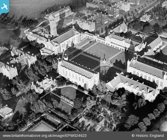
EPW024623 ENGLAND (1928). Christ's Hospital Chapel and Quadrangle, Horsham, 1928
© Copyright OpenStreetMap contributors and licensed by the OpenStreetMap Foundation. 2026. Cartography is licensed as CC BY-SA.
Nearby Images (13)
EPW024623

EPW024621

EAW037045

EPW024622

EPW024620

EPW024619

EAW030105

EAW037046

EPW039504

EAW030104

EAW037048

EAW037047

EPW039500

Details
| Title | [EPW024623] Christ's Hospital Chapel and Quadrangle, Horsham, 1928 |
| Reference | EPW024623 |
| Date | September-1928 |
| Link | |
| Place name | HORSHAM |
| Parish | SOUTHWATER |
| District | |
| Country | ENGLAND |
| Easting / Northing | 514806, 128442 |
| Longitude / Latitude | -0.36214971188068, 51.043309562162 |
| National Grid Reference | TQ148284 |
Pins
Be the first to add a comment to this image!