
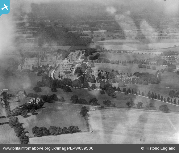
EPW039500 ENGLAND (1932). Christ's Hospital School and surrounding countryside, Southwater, 1932
© Copyright OpenStreetMap contributors and licensed by the OpenStreetMap Foundation. 2026. Cartography is licensed as CC BY-SA.
Nearby Images (10)
EPW039500

EPW039504

EAW037047

EPW024619

EAW037048

EPW024622

EAW037045

EPW024621

EPW024623

EAW030105

Details
| Title | [EPW039500] Christ's Hospital School and surrounding countryside, Southwater, 1932 |
| Reference | EPW039500 |
| Date | August-1932 |
| Link | |
| Place name | SOUTHWATER |
| Parish | SOUTHWATER |
| District | |
| Country | ENGLAND |
| Easting / Northing | 515047, 128513 |
| Longitude / Latitude | -0.35869049605285, 51.043899595524 |
| National Grid Reference | TQ150285 |
Pins
Be the first to add a comment to this image!