
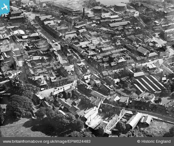
EPW024483 ENGLAND (1928). The Market Place and environs, Otley, 1928
© Copyright OpenStreetMap contributors and licensed by the OpenStreetMap Foundation. 2026. Cartography is licensed as CC BY-SA.
Nearby Images (11)
EPW024483

EPW024701

EPW015802

EPW015805

EPW015803

EPW015840

EPW015810

EPW015812

EPW024484

EPW015914

EPW015811

Details
| Title | [EPW024483] The Market Place and environs, Otley, 1928 |
| Reference | EPW024483 |
| Date | September-1928 |
| Link | |
| Place name | OTLEY |
| Parish | OTLEY |
| District | |
| Country | ENGLAND |
| Easting / Northing | 420195, 445528 |
| Longitude / Latitude | -1.6925794297892, 53.905316880578 |
| National Grid Reference | SE202455 |
Pins
Be the first to add a comment to this image!