
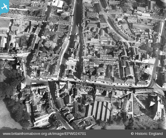
EPW024701 ENGLAND (1928). The Market Place, Otley, 1928
© Copyright OpenStreetMap contributors and licensed by the OpenStreetMap Foundation. 2026. Cartography is licensed as CC BY-SA.
Nearby Images (10)
EPW024701

EPW015805

EPW024483

EPW015802

EPW015803

EPW015840

EPW015810

EPW015812

EPW024484

EPW015811

Details
| Title | [EPW024701] The Market Place, Otley, 1928 |
| Reference | EPW024701 |
| Date | September-1928 |
| Link | |
| Place name | OTLEY |
| Parish | OTLEY |
| District | |
| Country | ENGLAND |
| Easting / Northing | 420226, 445515 |
| Longitude / Latitude | -1.692108395735, 53.905198818146 |
| National Grid Reference | SE202455 |
Pins

Mikeya |
Saturday 29th of November 2025 10:55:42 PM | |
|
Mikeya |
Saturday 29th of November 2025 10:55:09 PM | |
|
Mikeya |
Saturday 29th of November 2025 10:54:19 PM | |
|
Mikeya |
Saturday 29th of November 2025 10:53:51 PM | |
|
Mikeya |
Saturday 29th of November 2025 10:53:24 PM | |
|
Mikeya |
Saturday 29th of November 2025 10:52:34 PM | |
|
Mikeya |
Saturday 29th of November 2025 10:52:11 PM | |
|
Mikeya |
Saturday 29th of November 2025 10:51:44 PM | |
|
Mikeya |
Saturday 29th of November 2025 10:51:11 PM | |
Lynda Tubbs |
Tuesday 13th of May 2014 03:24:32 PM |