
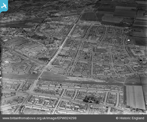
EPW024298 ENGLAND (1928). Housing surrounding Heathway, Becontree, 1928
© Copyright OpenStreetMap contributors and licensed by the OpenStreetMap Foundation. 2026. Cartography is licensed as CC BY-SA.
Nearby Images (3)
EPW024298

EPW024293

EPW024294

Details
| Title | [EPW024298] Housing surrounding Heathway, Becontree, 1928 |
| Reference | EPW024298 |
| Date | September-1928 |
| Link | |
| Place name | BECONTREE |
| Parish | |
| District | |
| Country | ENGLAND |
| Easting / Northing | 549172, 185045 |
| Longitude / Latitude | 0.15145432029145, 51.544079627999 |
| National Grid Reference | TQ492850 |
Pins

steve _b |
Saturday 30th of June 2012 05:30:50 PM |