
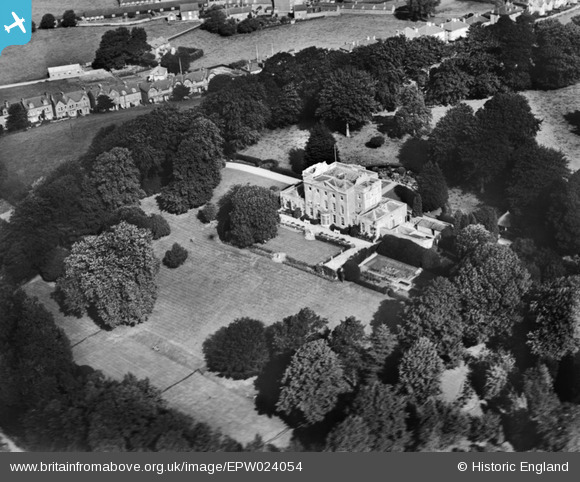
EPW024054 ENGLAND (1928). Downe Hall, Bridport, 1928
© Copyright OpenStreetMap contributors and licensed by the OpenStreetMap Foundation. 2026. Cartography is licensed as CC BY-SA.
Nearby Images (5)
EPW024054

EPW013520

EPW024052

EPW024045

EPW013518

Details
| Title | [EPW024054] Downe Hall, Bridport, 1928 |
| Reference | EPW024054 |
| Date | September-1928 |
| Link | |
| Place name | BRIDPORT |
| Parish | BRIDPORT |
| District | |
| Country | ENGLAND |
| Easting / Northing | 346732, 93195 |
| Longitude / Latitude | -2.7549228182126, 50.735351088983 |
| National Grid Reference | SY467932 |
Pins
Be the first to add a comment to this image!