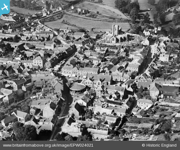
EPW024021 ENGLAND (1928). The town centre with fair in the Market Square, Crewkerne, 1928
© Copyright OpenStreetMap contributors and licensed by the OpenStreetMap Foundation. 2025. Cartography is licensed as CC BY-SA.
Nearby Images (6)
Details
| Title | [EPW024021] The town centre with fair in the Market Square, Crewkerne, 1928 |
| Reference | EPW024021 |
| Date | September-1928 |
| Link | |
| Place name | CREWKERNE |
| Parish | CREWKERNE |
| District | |
| Country | ENGLAND |
| Easting / Northing | 344109, 109811 |
| Longitude / Latitude | -2.7946238302857, 50.884527346304 |
| National Grid Reference | ST441098 |
Pins
 Class31 |
Monday 3rd of February 2014 09:29:18 AM | |
 Class31 |
Monday 3rd of February 2014 09:26:53 AM | |
 Class31 |
Monday 3rd of February 2014 09:25:36 AM | |
 Class31 |
Monday 3rd of February 2014 09:24:40 AM | |
 Class31 |
Monday 3rd of February 2014 09:22:39 AM | |
 Class31 |
Monday 3rd of February 2014 09:20:47 AM | |
 Class31 |
Monday 3rd of February 2014 09:19:48 AM | |
 Benny boy |
Sunday 17th of November 2013 11:35:51 PM | |
 MB |
Friday 29th of March 2013 01:30:22 PM |


![[EPW024021] The town centre with fair in the Market Square, Crewkerne, 1928](http://britainfromabove.org.uk/sites/all/libraries/aerofilms-images/public/100x100/EPW/024/EPW024021.jpg)
![[EPW024022] The town centre with fair in the Market Square, Crewkerne, 1928](http://britainfromabove.org.uk/sites/all/libraries/aerofilms-images/public/100x100/EPW/024/EPW024022.jpg)
![[EPW024026] The town, Crewkerne, from the north-east, 1928](http://britainfromabove.org.uk/sites/all/libraries/aerofilms-images/public/100x100/EPW/024/EPW024026.jpg)
![[EPW024020] St Bartholomew's Church and environs, Crewkerne, 1928](http://britainfromabove.org.uk/sites/all/libraries/aerofilms-images/public/100x100/EPW/024/EPW024020.jpg)
![[EPW024019] St Bartholomew's Church, Crewkerne, 1928](http://britainfromabove.org.uk/sites/all/libraries/aerofilms-images/public/100x100/EPW/024/EPW024019.jpg)
![[EPW024025] St Bartholomew's Church, Crewkerne, 1928](http://britainfromabove.org.uk/sites/all/libraries/aerofilms-images/public/100x100/EPW/024/EPW024025.jpg)