
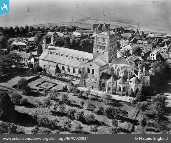
EPW023934 ENGLAND (1928). St Mary's Abbey, Tewkesbury, 1928
© Copyright OpenStreetMap contributors and licensed by the OpenStreetMap Foundation. 2026. Cartography is licensed as CC BY-SA.
Nearby Images (14)
EPW023934

EPW000182

EPW023946

EPW000181

EPW023940

EPW000180

EPW023937

EAW006888

EAW049071

EPW023944

EPW023938

EAW006887

EAW049069

EPW023945

Details
| Title | [EPW023934] St Mary's Abbey, Tewkesbury, 1928 |
| Reference | EPW023934 |
| Date | September-1928 |
| Link | |
| Place name | TEWKESBURY |
| Parish | TEWKESBURY |
| District | |
| Country | ENGLAND |
| Easting / Northing | 389083, 232422 |
| Longitude / Latitude | -2.1590016727515, 51.989716439788 |
| National Grid Reference | SO891324 |
Pins
Be the first to add a comment to this image!