
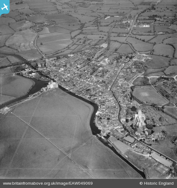
EAW049069 ENGLAND (1953). The town, Tewkesbury, from the south-west, 1953
© Copyright OpenStreetMap contributors and licensed by the OpenStreetMap Foundation. 2026. Cartography is licensed as CC BY-SA.
Nearby Images (11)
EAW049069

EPW023938

EPW023944

EAW049071

EPW023937

EPW000180

EPW023940

EPW023946

EPW000182

EPW000181

EPW023934

Details
| Title | [EAW049069] The town, Tewkesbury, from the south-west, 1953 |
| Reference | EAW049069 |
| Date | 5-May-1953 |
| Link | |
| Place name | TEWKESBURY |
| Parish | TEWKESBURY |
| District | |
| Country | ENGLAND |
| Easting / Northing | 388868, 232595 |
| Longitude / Latitude | -2.1621386650614, 51.991267738541 |
| National Grid Reference | SO889326 |


