
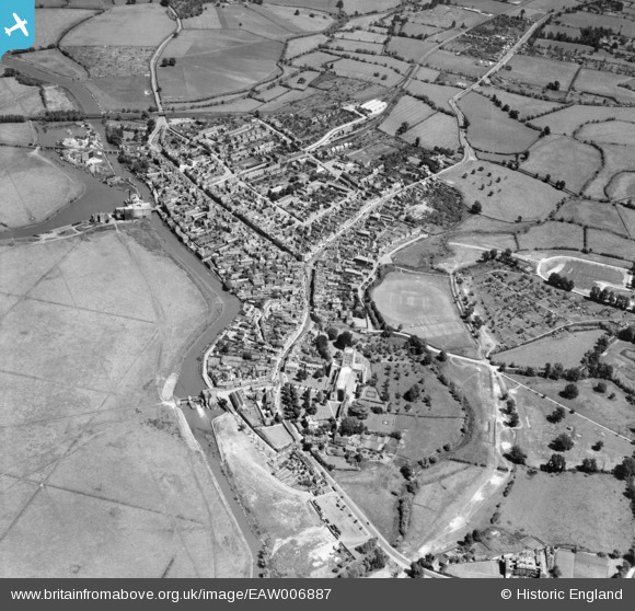
EAW006887 ENGLAND (1947). St Mary's Abbey and the town, Tewkesbury, 1947
© Copyright OpenStreetMap contributors and licensed by the OpenStreetMap Foundation. 2026. Cartography is licensed as CC BY-SA.
Nearby Images (10)
EAW006887

EPW023945

EAW006888

EPW023940

EPW023934

EPW023937

EPW023946

EPW000180

EPW000182

EPW000181

Details
| Title | [EAW006887] St Mary's Abbey and the town, Tewkesbury, 1947 |
| Reference | EAW006887 |
| Date | 10-June-1947 |
| Link | |
| Place name | TEWKESBURY |
| Parish | TEWKESBURY |
| District | |
| Country | ENGLAND |
| Easting / Northing | 389219, 232609 |
| Longitude / Latitude | -2.1570267772692, 51.991400548803 |
| National Grid Reference | SO892326 |
Pins

kevin nickson |
Thursday 26th of August 2021 03:31:00 PM | |

Billy Turner |
Friday 1st of January 2016 05:57:17 PM | |
|
alastair wallace |
Monday 19th of October 2015 07:15:13 PM | |
|
galatea |
Saturday 7th of February 2015 05:40:41 PM | |
|
galatea |
Saturday 7th of February 2015 05:38:42 PM | |
|
galatea |
Saturday 7th of February 2015 05:36:47 PM | |
|
galatea |
Saturday 7th of February 2015 05:35:26 PM | |
|
galatea |
Saturday 7th of February 2015 05:33:58 PM | |
|
galatea |
Saturday 7th of February 2015 05:33:15 PM | |
|
galatea |
Saturday 7th of February 2015 05:32:32 PM | |
|
galatea |
Thursday 15th of January 2015 11:06:02 PM |
