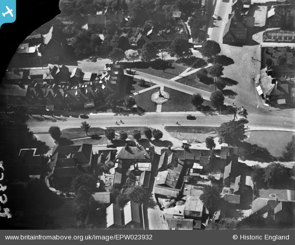
EPW023932 ENGLAND (1928). Church Green and the War Memorial, Harpenden, 1928
© Copyright OpenStreetMap contributors and licensed by the OpenStreetMap Foundation. 2026. Cartography is licensed as CC BY-SA.
Nearby Images (5)
Details
| Title | [EPW023932] Church Green and the War Memorial, Harpenden, 1928 |
| Reference | EPW023932 |
| Date | September-1928 |
| Link | |
| Place name | HARPENDEN |
| Parish | HARPENDEN |
| District | |
| Country | ENGLAND |
| Easting / Northing | 513365, 214344 |
| Longitude / Latitude | -0.35519734993231, 51.81576616961 |
| National Grid Reference | TL134143 |
Pins

Keith Davison |
Friday 30th of March 2018 11:20:52 PM | |

Chells809 |
Thursday 24th of July 2014 10:00:52 PM | |

melgibbs |
Tuesday 7th of January 2014 04:12:24 PM |


![[EPW023932] Church Green and the War Memorial, Harpenden, 1928](http://britainfromabove.org.uk/sites/all/libraries/aerofilms-images/public/100x100/EPW/023/EPW023932.jpg)
![[EPW023925] Church Green and the War Memorial, Harpenden, 1928](http://britainfromabove.org.uk/sites/all/libraries/aerofilms-images/public/100x100/EPW/023/EPW023925.jpg)
![[EPW023931] Leyton Green and environs, Harpenden, 1928](http://britainfromabove.org.uk/sites/all/libraries/aerofilms-images/public/100x100/EPW/023/EPW023931.jpg)
![[EAW047644] Harpenden Public Halls and Vaughan Road, Harpenden, 1952](http://britainfromabove.org.uk/sites/all/libraries/aerofilms-images/public/100x100/EAW/047/EAW047644.jpg)
![[EPW023930] Leyton Green and the High Street, Harpenden, 1928](http://britainfromabove.org.uk/sites/all/libraries/aerofilms-images/public/100x100/EPW/023/EPW023930.jpg)