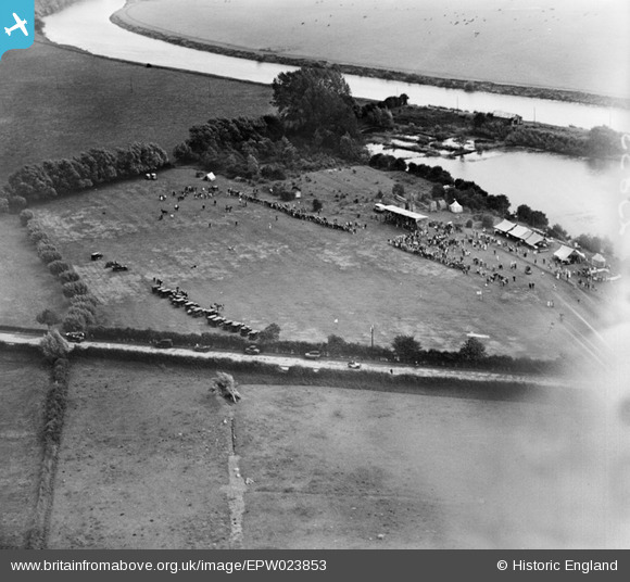
EPW023853 ENGLAND (1928). An event on the east bank of the River Severn, Upton-upon-Severn, 1928
© Copyright OpenStreetMap contributors and licensed by the OpenStreetMap Foundation. 2025. Cartography is licensed as CC BY-SA.
Details
| Title | [EPW023853] An event on the east bank of the River Severn, Upton-upon-Severn, 1928 |
| Reference | EPW023853 |
| Date | September-1928 |
| Link | |
| Place name | UPTON-UPON-SEVERN |
| Parish | UPTON-UPON-SEVERN |
| District | |
| Country | ENGLAND |
| Easting / Northing | 385539, 240855 |
| Longitude / Latitude | -2.2109747812314, 52.065461931683 |
| National Grid Reference | SO855409 |
Pins

Stephen Peters |
Saturday 25th of August 2012 10:06:02 AM | |

Stephen Peters |
Saturday 25th of August 2012 10:05:26 AM | |

Stephen Peters |
Saturday 25th of August 2012 10:04:21 AM |
User Comment Contributions
Looks like a horse event, there are several horses around the field by the cars and at the top of the field. |

Keiththechippy |
Saturday 29th of November 2014 08:11:24 AM |


![[EPW023853] An event on the east bank of the River Severn, Upton-upon-Severn, 1928](http://britainfromabove.org.uk/sites/all/libraries/aerofilms-images/public/100x100/EPW/023/EPW023853.jpg)
![[EPW023852] An event on the east bank of the River Severn, Upton-upon-Severn, 1928](http://britainfromabove.org.uk/sites/all/libraries/aerofilms-images/public/100x100/EPW/023/EPW023852.jpg)
![[EAW004013A] Flooding along the River Severn, Upton-upon-Severn, from the south-west, 1947. This image has been produced from a damaged negative.](http://britainfromabove.org.uk/sites/all/libraries/aerofilms-images/public/100x100/EAW/004/EAW004013A.jpg)
![[EPW023854] Bankside House and environs, Upton-upon-Severn, 1928](http://britainfromabove.org.uk/sites/all/libraries/aerofilms-images/public/100x100/EPW/023/EPW023854.jpg)