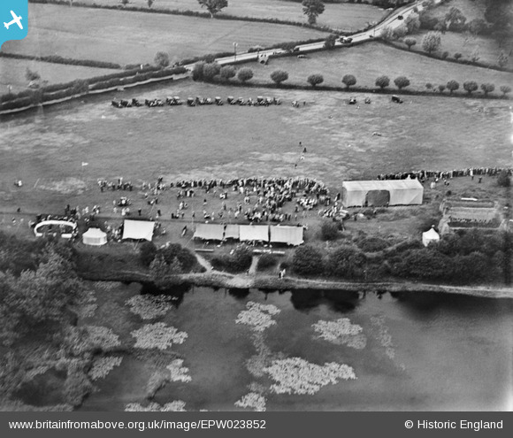
EPW023852 ENGLAND (1928). An event on the east bank of the River Severn, Upton-upon-Severn, 1928
© Copyright OpenStreetMap contributors and licensed by the OpenStreetMap Foundation. 2025. Cartography is licensed as CC BY-SA.
Details
| Title | [EPW023852] An event on the east bank of the River Severn, Upton-upon-Severn, 1928 |
| Reference | EPW023852 |
| Date | September-1928 |
| Link | |
| Place name | UPTON-UPON-SEVERN |
| Parish | UPTON-UPON-SEVERN |
| District | |
| Country | ENGLAND |
| Easting / Northing | 385526, 240815 |
| Longitude / Latitude | -2.2111627434569, 52.065101928876 |
| National Grid Reference | SO855408 |
Pins

Stephen Peters |
Saturday 25th of August 2012 10:01:31 AM | |

Stephen Peters |
Saturday 25th of August 2012 10:00:23 AM |


![[EPW023852] An event on the east bank of the River Severn, Upton-upon-Severn, 1928](http://britainfromabove.org.uk/sites/all/libraries/aerofilms-images/public/100x100/EPW/023/EPW023852.jpg)
![[EPW023853] An event on the east bank of the River Severn, Upton-upon-Severn, 1928](http://britainfromabove.org.uk/sites/all/libraries/aerofilms-images/public/100x100/EPW/023/EPW023853.jpg)
![[EAW004013A] Flooding along the River Severn, Upton-upon-Severn, from the south-west, 1947. This image has been produced from a damaged negative.](http://britainfromabove.org.uk/sites/all/libraries/aerofilms-images/public/100x100/EAW/004/EAW004013A.jpg)
![[EPW023854] Bankside House and environs, Upton-upon-Severn, 1928](http://britainfromabove.org.uk/sites/all/libraries/aerofilms-images/public/100x100/EPW/023/EPW023854.jpg)