
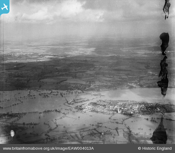
EAW004013A ENGLAND (1947). Flooding along the River Severn, Upton-upon-Severn, from the south-west, 1947. This image has been produced from a damaged negative.
© Copyright OpenStreetMap contributors and licensed by the OpenStreetMap Foundation. 2026. Cartography is licensed as CC BY-SA.
Nearby Images (4)
EAW004013A

EPW023853

EPW023852

EPW023854

Details
| Title | [EAW004013A] Flooding along the River Severn, Upton-upon-Severn, from the south-west, 1947. This image has been produced from a damaged negative. |
| Reference | EAW004013A |
| Date | 21-March-1947 |
| Link | |
| Place name | UPTON-UPON-SEVERN |
| Parish | UPTON-UPON-SEVERN |
| District | |
| Country | ENGLAND |
| Easting / Northing | 385575, 240829 |
| Longitude / Latitude | -2.2104484741037, 52.065229089524 |
| National Grid Reference | SO856408 |
Pins
Be the first to add a comment to this image!