
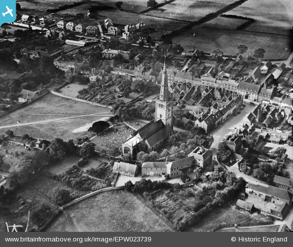
EPW023739 ENGLAND (1928). St Peter & St Paul's Church, Coleshill, 1928
© Copyright OpenStreetMap contributors and licensed by the OpenStreetMap Foundation. 2025. Cartography is licensed as CC BY-SA.
Nearby Images (6)
EPW023739

EAW024255

EAW024254

EAW024256

EAW024257

EPW023740

Details
| Title | [EPW023739] St Peter & St Paul's Church, Coleshill, 1928 |
| Reference | EPW023739 |
| Date | September-1928 |
| Link | |
| Place name | COLESHILL |
| Parish | COLESHILL |
| District | |
| Country | ENGLAND |
| Easting / Northing | 420091, 289024 |
| Longitude / Latitude | -1.704017232672, 52.498382972529 |
| National Grid Reference | SP201890 |
Pins
Be the first to add a comment to this image!