
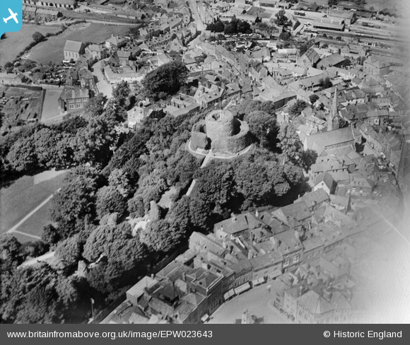
EPW023643 ENGLAND (1928). Launceston Castle, Launceston, 1928
© Copyright OpenStreetMap contributors and licensed by the OpenStreetMap Foundation. 2026. Cartography is licensed as CC BY-SA.
Nearby Images (16)
EPW023643

EAW005835

EAW014993

EAW005836

EAW005834

EPW054781

EAW014992

EAW005838

EAW005837

EPW054782

EPW023648

EPW023649

EPW054779

EAW014991

EPW023650

EPW011305

Details
| Title | [EPW023643] Launceston Castle, Launceston, 1928 |
| Reference | EPW023643 |
| Date | September-1928 |
| Link | |
| Place name | LAUNCESTON |
| Parish | LAUNCESTON |
| District | |
| Country | ENGLAND |
| Easting / Northing | 233111, 84626 |
| Longitude / Latitude | -4.3603462348188, 50.636818147673 |
| National Grid Reference | SX331846 |
Pins

Class31 |
Saturday 1st of December 2012 06:22:07 AM | |
|
Class31 |
Saturday 1st of December 2012 06:21:09 AM | |
|
Class31 |
Saturday 1st of December 2012 06:20:19 AM | |
|
Class31 |
Saturday 1st of December 2012 06:18:44 AM | |
|
Class31 |
Saturday 1st of December 2012 06:17:37 AM | |
|
Class31 |
Saturday 1st of December 2012 06:17:20 AM |
User Comment Contributions

Launceston Castle |

Robert - Cumbria |
Wednesday 27th of June 2012 07:08:09 PM |