
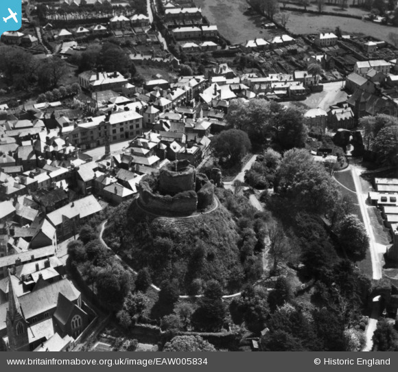
EAW005834 ENGLAND (1947). The castle, Launceston, 1947. This image has been produced from a print.
© Copyright OpenStreetMap contributors and licensed by the OpenStreetMap Foundation. 2026. Cartography is licensed as CC BY-SA.
Nearby Images (16)
EAW005834

EPW054781

EAW005835

EAW014993

EAW005836

EPW023643

EAW005838

EAW005837

EAW014992

EPW054782

EAW014991

EPW023648

EPW023649

EPW023650

EPW054779

EPW011305

Details
| Title | [EAW005834] The castle, Launceston, 1947. This image has been produced from a print. |
| Reference | EAW005834 |
| Date | 18-May-1947 |
| Link | |
| Place name | LAUNCESTON |
| Parish | LAUNCESTON |
| District | |
| Country | ENGLAND |
| Easting / Northing | 233103, 84644 |
| Longitude / Latitude | -4.3604673842109, 50.636977608184 |
| National Grid Reference | SX331846 |
Pins
Be the first to add a comment to this image!