
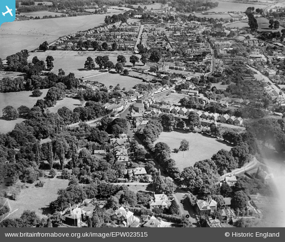
EPW023515 ENGLAND (1928). The town, Egham, from the south-west, 1928
© Copyright OpenStreetMap contributors and licensed by the OpenStreetMap Foundation. 2026. Cartography is licensed as CC BY-SA.
Nearby Images (4)
EPW023515

EPW026269

EAW002312

EPW023504

Details
| Title | [EPW023515] The town, Egham, from the south-west, 1928 |
| Reference | EPW023515 |
| Date | September-1928 |
| Link | |
| Place name | EGHAM |
| Parish | |
| District | |
| Country | ENGLAND |
| Easting / Northing | 500424, 171165 |
| Longitude / Latitude | -0.55527041343824, 51.430087229387 |
| National Grid Reference | TQ004712 |
Pins

Cuttin' |
Wednesday 28th of September 2022 01:38:43 AM | |
|
Cuttin' |
Wednesday 28th of September 2022 01:37:48 AM | |
|
David960 |
Thursday 29th of October 2015 07:29:41 PM | |
|
bumblee |
Friday 19th of December 2014 03:32:38 PM | |

Class31 |
Tuesday 30th of October 2012 05:04:40 PM | |
|
Class31 |
Tuesday 30th of October 2012 05:04:25 PM | |
|
Class31 |
Tuesday 30th of October 2012 05:04:08 PM | |
|
Class31 |
Tuesday 30th of October 2012 05:03:49 PM |
User Comment Contributions

Strode's College, 07/09/2015 |
Class31 |
Tuesday 8th of September 2015 08:48:17 PM |