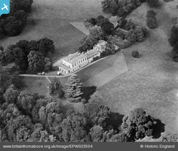
EPW023504 ENGLAND (1928). Runnymede Park, Egham, 1928
© Copyright OpenStreetMap contributors and licensed by the OpenStreetMap Foundation. 2026. Cartography is licensed as CC BY-SA.
Nearby Images (8)
Details
| Title | [EPW023504] Runnymede Park, Egham, 1928 |
| Reference | EPW023504 |
| Date | September-1928 |
| Link | |
| Place name | EGHAM |
| Parish | |
| District | |
| Country | ENGLAND |
| Easting / Northing | 500230, 171345 |
| Longitude / Latitude | -0.55800945565241, 51.43173974314 |
| National Grid Reference | TQ002713 |
Pins
Be the first to add a comment to this image!


![[EPW023504] Runnymede Park, Egham, 1928](http://britainfromabove.org.uk/sites/all/libraries/aerofilms-images/public/100x100/EPW/023/EPW023504.jpg)
![[EAW002312] Runnymede Park and environs, Englefield Green, from the south, 1946](http://britainfromabove.org.uk/sites/all/libraries/aerofilms-images/public/100x100/EAW/002/EAW002312.jpg)
![[EAW002307] Egham Hill Roundabout and Runnymede Park, Englefield Green, 1946](http://britainfromabove.org.uk/sites/all/libraries/aerofilms-images/public/100x100/EAW/002/EAW002307.jpg)
![[EAW002311] Runnymede Park, Englefield Green, 1946](http://britainfromabove.org.uk/sites/all/libraries/aerofilms-images/public/100x100/EAW/002/EAW002311.jpg)
![[EAW002304] Runnymede Park, Englefield Green, 1946](http://britainfromabove.org.uk/sites/all/libraries/aerofilms-images/public/100x100/EAW/002/EAW002304.jpg)
![[EAW002306] Runnymede Park, Englefield Green, 1946](http://britainfromabove.org.uk/sites/all/libraries/aerofilms-images/public/100x100/EAW/002/EAW002306.jpg)
![[EPW023515] The town, Egham, from the south-west, 1928](http://britainfromabove.org.uk/sites/all/libraries/aerofilms-images/public/100x100/EPW/023/EPW023515.jpg)
![[EAW002310] Lime Lodge and Runnymede Park, Englefield Green, 1946](http://britainfromabove.org.uk/sites/all/libraries/aerofilms-images/public/100x100/EAW/002/EAW002310.jpg)