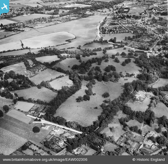
EAW002306 ENGLAND (1946). Runnymede Park, Englefield Green, 1946
© Copyright OpenStreetMap contributors and licensed by the OpenStreetMap Foundation. 2026. Cartography is licensed as CC BY-SA.
Nearby Images (9)
Details
| Title | [EAW002306] Runnymede Park, Englefield Green, 1946 |
| Reference | EAW002306 |
| Date | 21-August-1946 |
| Link | |
| Place name | ENGLEFIELD GREEN |
| Parish | |
| District | |
| Country | ENGLAND |
| Easting / Northing | 500104, 171550 |
| Longitude / Latitude | -0.5597636207042, 51.433604925076 |
| National Grid Reference | TQ001716 |
Pins

Sparky |
Monday 18th of September 2017 12:04:44 AM | |

Ellensdottir |
Sunday 1st of September 2013 07:35:25 PM | |

Ellensdottir |
Sunday 1st of September 2013 07:34:40 PM | |

Ellensdottir |
Sunday 1st of September 2013 07:33:58 PM | |

Ellensdottir |
Sunday 1st of September 2013 07:33:33 PM | |

Ellensdottir |
Sunday 1st of September 2013 07:27:31 PM | |

Ellensdottir |
Sunday 1st of September 2013 07:25:15 PM | |

Ellensdottir |
Sunday 1st of September 2013 07:22:49 PM | |

Ellensdottir |
Sunday 1st of September 2013 07:21:36 PM |


![[EAW002306] Runnymede Park, Englefield Green, 1946](http://britainfromabove.org.uk/sites/all/libraries/aerofilms-images/public/100x100/EAW/002/EAW002306.jpg)
![[EAW002305] Runnymede Park, Englefield Green, 1946](http://britainfromabove.org.uk/sites/all/libraries/aerofilms-images/public/100x100/EAW/002/EAW002305.jpg)
![[EAW002311] Runnymede Park, Englefield Green, 1946](http://britainfromabove.org.uk/sites/all/libraries/aerofilms-images/public/100x100/EAW/002/EAW002311.jpg)
![[EAW002310] Lime Lodge and Runnymede Park, Englefield Green, 1946](http://britainfromabove.org.uk/sites/all/libraries/aerofilms-images/public/100x100/EAW/002/EAW002310.jpg)
![[EAW002303] Runnymede Park, Englefield Green, 1946](http://britainfromabove.org.uk/sites/all/libraries/aerofilms-images/public/100x100/EAW/002/EAW002303.jpg)
![[EAW002307] Egham Hill Roundabout and Runnymede Park, Englefield Green, 1946](http://britainfromabove.org.uk/sites/all/libraries/aerofilms-images/public/100x100/EAW/002/EAW002307.jpg)
![[EAW002309] Runnymede Park, Englefield Green, 1946](http://britainfromabove.org.uk/sites/all/libraries/aerofilms-images/public/100x100/EAW/002/EAW002309.jpg)
![[EPW023504] Runnymede Park, Egham, 1928](http://britainfromabove.org.uk/sites/all/libraries/aerofilms-images/public/100x100/EPW/023/EPW023504.jpg)
![[EAW002312] Runnymede Park and environs, Englefield Green, from the south, 1946](http://britainfromabove.org.uk/sites/all/libraries/aerofilms-images/public/100x100/EAW/002/EAW002312.jpg)