
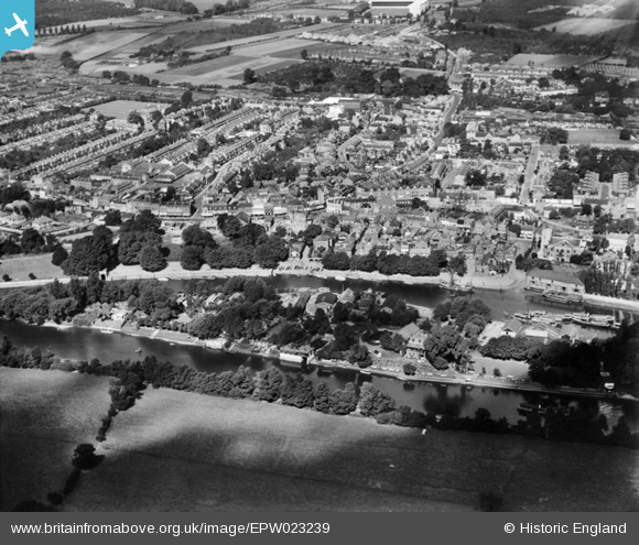
EPW023239 ENGLAND (1928). Eel Pie Island and The Embankment, Twickenham, 1928
© Copyright OpenStreetMap contributors and licensed by the OpenStreetMap Foundation. 2026. Cartography is licensed as CC BY-SA.
Nearby Images (8)
EPW023239

EPW023246

EAW025281

EPW022846

EPW023238

EAW025280

EAW025282

EPR000467

Details
| Title | [EPW023239] Eel Pie Island and The Embankment, Twickenham, 1928 |
| Reference | EPW023239 |
| Date | September-1928 |
| Link | |
| Place name | TWICKENHAM |
| Parish | |
| District | |
| Country | ENGLAND |
| Easting / Northing | 516354, 173212 |
| Longitude / Latitude | -0.32552180601565, 51.445439611087 |
| National Grid Reference | TQ164732 |
Pins

Martin Devlin |
Sunday 4th of April 2021 12:41:49 PM | |
|
Joe90 |
Saturday 11th of January 2014 11:33:29 PM | |
|
Arty |
Friday 19th of October 2012 06:23:44 PM | |
|
Chelsea61 |
Sunday 29th of July 2012 06:14:22 PM |