
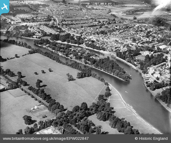
EPW022847 ENGLAND (1928). Eel Pie Island, Twickenham, 1928
© Copyright OpenStreetMap contributors and licensed by the OpenStreetMap Foundation. 2026. Cartography is licensed as CC BY-SA.
Nearby Images (6)
EPW022847

EAW025282

EPW022846

EAW025280

EPW023248

EAW025281

Details
| Title | [EPW022847] Eel Pie Island, Twickenham, 1928 |
| Reference | EPW022847 |
| Date | August-1928 |
| Link | |
| Place name | TWICKENHAM |
| Parish | |
| District | |
| Country | ENGLAND |
| Easting / Northing | 516628, 173141 |
| Longitude / Latitude | -0.32160382587173, 51.444745040232 |
| National Grid Reference | TQ166731 |
Pins

Ian |
Monday 20th of July 2015 03:24:27 PM |