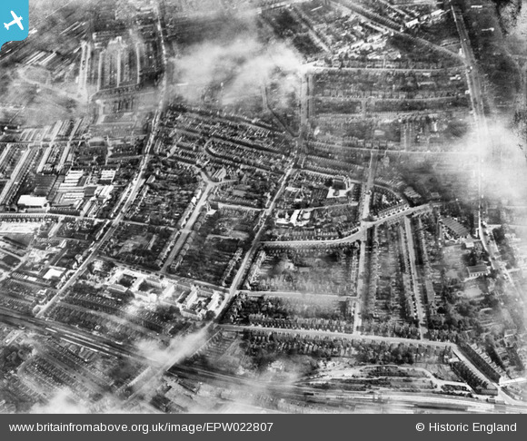
EPW022807 ENGLAND (1928). The Larkhall Estate, Lambeth, from the south-west, 1928
© Copyright OpenStreetMap contributors and licensed by the OpenStreetMap Foundation. 2026. Cartography is licensed as CC BY-SA.
Nearby Images (17)
EPW022807

EPW022809

EPW017667

EAW030135

EPW024228

EPW024226

EPW024229

EAW000473

EPW017169

EAW000471

EAW000470

EAW000475

EPW024227

EPW024225

EPW017172

EAW000474

EPW022806

Details
| Title | [EPW022807] The Larkhall Estate, Lambeth, from the south-west, 1928 |
| Reference | EPW022807 |
| Date | August-1928 |
| Link | |
| Place name | LAMBETH |
| Parish | |
| District | |
| Country | ENGLAND |
| Easting / Northing | 529736, 176081 |
| Longitude / Latitude | -0.1319899358328, 51.468317753326 |
| National Grid Reference | TQ297761 |