
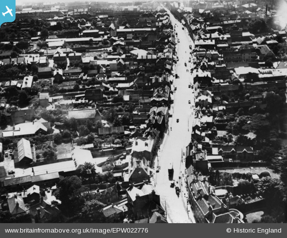
EPW022776 ENGLAND (1928). High Street, Uxbridge, 1928. This image has been produced from a print.
© Copyright OpenStreetMap contributors and licensed by the OpenStreetMap Foundation. 2026. Cartography is licensed as CC BY-SA.
Nearby Images (7)
EPW022776

EPW022771

EPW001578

EPW031258

EPW041117

EPW031256

EPW041116

Details
| Title | [EPW022776] High Street, Uxbridge, 1928. This image has been produced from a print. |
| Reference | EPW022776 |
| Date | August-1928 |
| Link | |
| Place name | UXBRIDGE |
| Parish | |
| District | |
| Country | ENGLAND |
| Easting / Northing | 505435, 184363 |
| Longitude / Latitude | -0.47926448255677, 51.547818410213 |
| National Grid Reference | TQ054844 |
