
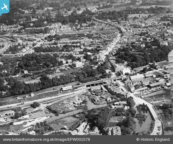
EPW001578 ENGLAND (1920). The High Street and environs, Uxbridge, 1920. This image has been produced from a copy-negative.
© Copyright OpenStreetMap contributors and licensed by the OpenStreetMap Foundation. 2026. Cartography is licensed as CC BY-SA.
Nearby Images (7)
EPW001578

EPW022771

EPW022776

EAW034864

EAW034871

EAW034875

EPW022779

Details
| Title | [EPW001578] The High Street and environs, Uxbridge, 1920. This image has been produced from a copy-negative. |
| Reference | EPW001578 |
| Date | June-1920 |
| Link | |
| Place name | UXBRIDGE |
| Parish | |
| District | |
| Country | ENGLAND |
| Easting / Northing | 505355, 184503 |
| Longitude / Latitude | -0.48037598519234, 51.549091853243 |
| National Grid Reference | TQ054845 |
Pins

M |
Tuesday 24th of September 2024 01:36:34 AM | |
|
The Laird |
Sunday 6th of March 2016 07:20:14 PM | |
|
The Laird |
Sunday 6th of March 2016 07:10:05 PM | |
|
moses72 |
Friday 6th of November 2015 05:49:20 PM | |
|
moses72 |
Thursday 2nd of October 2014 05:37:00 PM | |
|
moses72 |
Friday 5th of September 2014 06:29:31 PM | |
|
moses72 |
Friday 5th of September 2014 06:28:12 PM | |
|
moses72 |
Friday 5th of September 2014 06:26:06 PM | |
|
moses72 |
Friday 5th of September 2014 06:23:35 PM | |
|
moses72 |
Friday 5th of September 2014 06:19:45 PM | |
|
moses72 |
Friday 5th of September 2014 06:09:40 PM | |
The over bridge was built in anticipation of this taking place (it was removed in 1922). Some initial ground works were also undertaken on the line of the anticipated connection. |
The Laird |
Sunday 6th of March 2016 07:04:30 PM |