
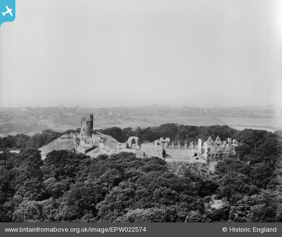
EPW022574 ENGLAND (1928). Dudley Castle, Dudley, from the east, 1928
© Copyright OpenStreetMap contributors and licensed by the OpenStreetMap Foundation. 2026. Cartography is licensed as CC BY-SA.
Nearby Images (19)
EPW022574

EAW001192

EAW045890

EAW045891

EAW001196

EAW007504

EAW007501

EAW001195

EAW007506

EAW007505

EAW007503

EAW007507

EAW045886

EPW022573

EAW045888

EAW045887

EAW001193

EAW007502

EAW001194

Details
| Title | [EPW022574] Dudley Castle, Dudley, from the east, 1928 |
| Reference | EPW022574 |
| Date | 7-August-1928 |
| Link | |
| Place name | DUDLEY |
| Parish | |
| District | |
| Country | ENGLAND |
| Easting / Northing | 394892, 290739 |
| Longitude / Latitude | -2.0752784524396, 52.514148694545 |
| National Grid Reference | SO949907 |
Pins
Be the first to add a comment to this image!
User Comment Contributions

This is a classic 'motte and bailey' castle. You can see the more easily defended, round keep on top of its mound or motte to the left. The bailey was a larger area where there were outbuildings such as stables and where local people and animals could take refuge when the area was under attack. Dudley Zoo was constructed among the woodland surrounding the castle. It opened to the public in May 1937 and is still there today (2013). Find more images of castle on Britain from Above and on the Heritage Explorer website http://www.heritage-explorer.co.uk/web/he/imagebytheme.aspx?ctid=15 |

MM |
Thursday 31st of October 2013 03:24:10 PM |