
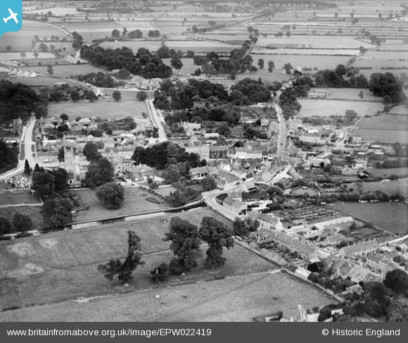
EPW022419 ENGLAND (1928). The Town Centre, Fairford, from the north-west, 1928
© Copyright OpenStreetMap contributors and licensed by the OpenStreetMap Foundation. 2026. Cartography is licensed as CC BY-SA.
Nearby Images (5)
EPW022419

EPW022420

EPW022422

EPW022423

EPW022425

Details
| Title | [EPW022419] The Town Centre, Fairford, from the north-west, 1928 |
| Reference | EPW022419 |
| Date | August-1928 |
| Link | |
| Place name | FAIRFORD |
| Parish | FAIRFORD |
| District | |
| Country | ENGLAND |
| Easting / Northing | 415033, 201079 |
| Longitude / Latitude | -1.7824141252119, 51.707786927334 |
| National Grid Reference | SP150011 |
Pins
Lynda Tubbs |
Thursday 16th of January 2014 12:18:34 PM |
User Comment Contributions
View of Fairford, showing the parish church of St Mary. |
Hefin Meara |
Tuesday 22nd of January 2013 11:41:36 AM |