
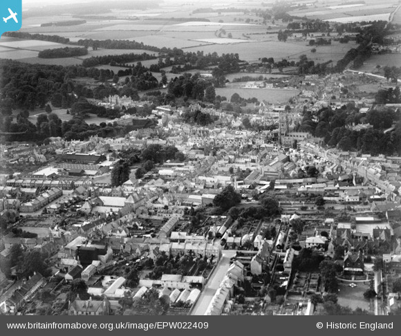
EPW022409 ENGLAND (1928). The Town Centre, Cirencester, from the south-east, 1928
© Copyright OpenStreetMap contributors and licensed by the OpenStreetMap Foundation. 2026. Cartography is licensed as CC BY-SA.
Nearby Images (11)
EPW022409

EAW006878

EAW006876

EPW022414

EPW022415

EAW031678

EPW022417

EPW022413

EPW006310

EPW022410

EPW022407

Details
| Title | [EPW022409] The Town Centre, Cirencester, from the south-east, 1928 |
| Reference | EPW022409 |
| Date | August-1928 |
| Link | |
| Place name | CIRENCESTER |
| Parish | CIRENCESTER |
| District | |
| Country | ENGLAND |
| Easting / Northing | 402452, 201803 |
| Longitude / Latitude | -1.9645048104965, 51.714493363893 |
| National Grid Reference | SP025018 |
Pins

SydM |
Sunday 31st of March 2013 02:19:17 PM | |
Comment regarding this building as Mycalex was in 1928 The Cotswold garage and not Mycalex until 1940.The actual structure was in fact one of the hangers from North Cerney airfield that was dis-mantled after the First World War and re-erected in the yard that was entered from Ashcroft Road.Two other hangers were also erected,one adjacent to the Cotswold for Bridges Garage and one half a hanger at the top of Ashcroft Road for Harmans the builder. |
cherrytree |
Sunday 23rd of August 2015 04:19:34 PM |

Class31 |
Thursday 24th of January 2013 08:16:34 PM | |
|
Class31 |
Thursday 24th of January 2013 08:15:57 PM | |
|
Class31 |
Thursday 24th of January 2013 08:13:52 PM | |
|
Class31 |
Thursday 24th of January 2013 08:13:09 PM | |
|
Class31 |
Thursday 24th of January 2013 08:04:22 PM | |
|
Class31 |
Thursday 24th of January 2013 08:03:24 PM | |
|
Class31 |
Thursday 24th of January 2013 08:00:41 PM | |
|
Class31 |
Thursday 24th of January 2013 07:59:14 PM | |
|
Class31 |
Thursday 24th of January 2013 07:57:42 PM | |
|
Class31 |
Sunday 28th of October 2012 11:27:10 PM | |
|
Class31 |
Friday 5th of October 2012 09:06:44 PM | |
|
Tetbury |
Wednesday 27th of June 2012 01:23:59 AM | |
|
Tetbury |
Wednesday 27th of June 2012 01:23:02 AM |