
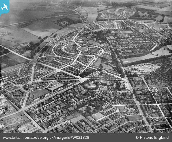
EPW021828 ENGLAND (1928). Collin Green and Mansfield Road, Sherwood, 1928
© Copyright OpenStreetMap contributors and licensed by the OpenStreetMap Foundation. 2026. Cartography is licensed as CC BY-SA.
Nearby Images (5)
EPW021828

EPW021826

EPW021827

EPW021825

EPW021824

Details
| Title | [EPW021828] Collin Green and Mansfield Road, Sherwood, 1928 |
| Reference | EPW021828 |
| Date | June-1928 |
| Link | |
| Place name | SHERWOOD |
| Parish | |
| District | |
| Country | ENGLAND |
| Easting / Northing | 457446, 343566 |
| Longitude / Latitude | -1.1441919914253, 52.986038864829 |
| National Grid Reference | SK574436 |
Pins

spc |
Sunday 24th of November 2019 04:22:42 PM | |
|
spc |
Sunday 24th of November 2019 04:21:43 PM | |
|
John Wass |
Thursday 4th of May 2017 02:22:02 PM | |
|
poohdog |
Wednesday 9th of July 2014 12:09:07 AM | |
|
poohdog |
Wednesday 9th of July 2014 12:04:47 AM | |
|
poohdog |
Wednesday 9th of July 2014 12:02:38 AM | |
|
poohdog |
Wednesday 9th of July 2014 12:00:06 AM | |
|
poohdog |
Tuesday 8th of July 2014 11:58:19 PM | |
|
poohdog |
Tuesday 8th of July 2014 11:57:11 PM |