
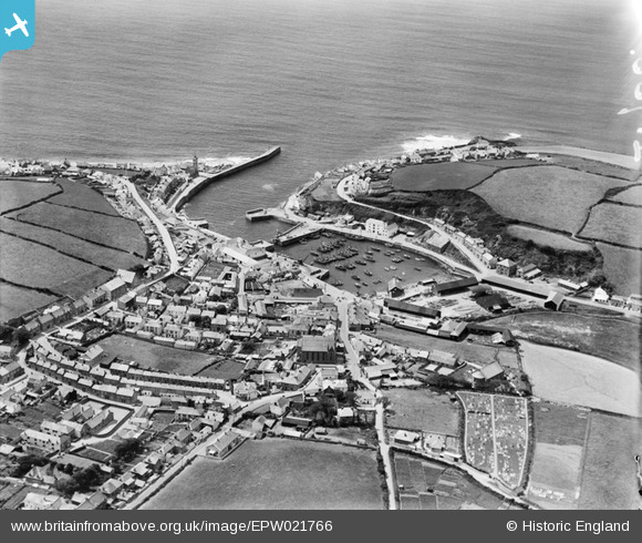
EPW021766 ENGLAND (1928). The harbour and town, Porthleven, 1928
© Copyright OpenStreetMap contributors and licensed by the OpenStreetMap Foundation. 2026. Cartography is licensed as CC BY-SA.
Nearby Images (3)
EPW021766

EAW015146

EPW021765

Details
| Title | [EPW021766] The harbour and town, Porthleven, 1928 |
| Reference | EPW021766 |
| Date | 24-June-1928 |
| Link | |
| Place name | PORTHLEVEN |
| Parish | PORTHLEVEN |
| District | |
| Country | ENGLAND |
| Easting / Northing | 162843, 25743 |
| Longitude / Latitude | -5.3155541116831, 50.083759029672 |
| National Grid Reference | SW628257 |
