
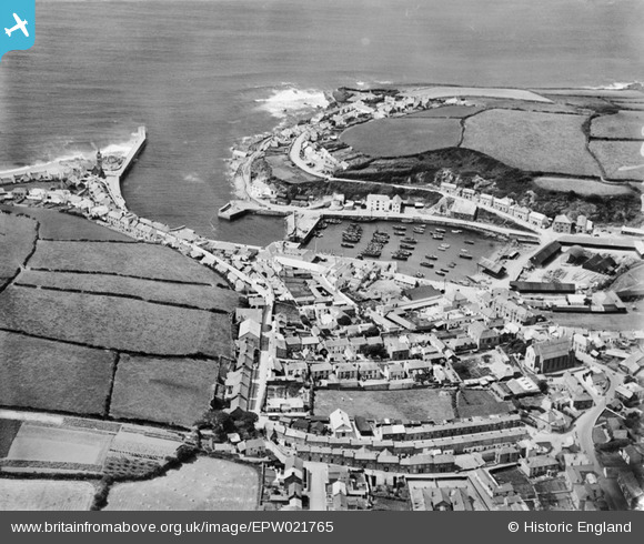
EPW021765 ENGLAND (1928). The harbour and town, Porthleven, 1928
© Copyright OpenStreetMap contributors and licensed by the OpenStreetMap Foundation. 2026. Cartography is licensed as CC BY-SA.
Nearby Images (3)
EPW021765

EAW015146

EPW021766

Details
| Title | [EPW021765] The harbour and town, Porthleven, 1928 |
| Reference | EPW021765 |
| Date | 24-June-1928 |
| Link | |
| Place name | PORTHLEVEN |
| Parish | PORTHLEVEN |
| District | |
| Country | ENGLAND |
| Easting / Northing | 162877, 25732 |
| Longitude / Latitude | -5.3150728003991, 50.083673818545 |
| National Grid Reference | SW629257 |
Pins

redmist |
Monday 29th of August 2022 04:09:10 PM | |
|
Duncan Brown |
Wednesday 10th of May 2017 10:11:19 AM | |
|
Coppersmiths |
Saturday 26th of July 2014 02:20:48 PM | |
 |
Coppersmiths |
Saturday 26th of July 2014 02:09:07 PM |
 |
Coppersmiths |
Saturday 26th of July 2014 02:05:17 PM |
|
MB |
Wednesday 5th of September 2012 01:37:06 PM | |
|
MB |
Wednesday 5th of September 2012 01:30:35 PM | |
|
MB |
Wednesday 5th of September 2012 01:27:33 PM | |
|
MB |
Wednesday 5th of September 2012 01:21:49 PM | |
|
MB |
Wednesday 5th of September 2012 01:21:32 PM |