
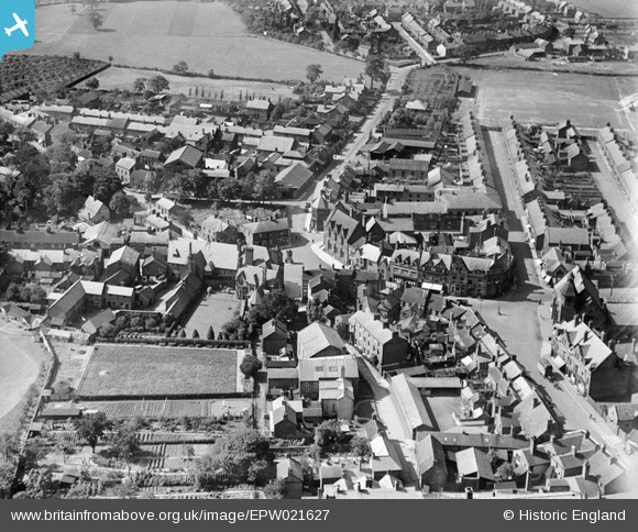
EPW021627 ENGLAND (1928). The town centre, Sandbach, 1928
© Copyright OpenStreetMap contributors and licensed by the OpenStreetMap Foundation. 2026. Cartography is licensed as CC BY-SA.
Nearby Images (5)
EPW021627

EPW021623

EPW021625

EPW021624

EPW021622

Details
| Title | [EPW021627] The town centre, Sandbach, 1928 |
| Reference | EPW021627 |
| Date | June-1928 |
| Link | |
| Place name | SANDBACH |
| Parish | SANDBACH |
| District | |
| Country | ENGLAND |
| Easting / Northing | 375694, 360888 |
| Longitude / Latitude | -2.3634278266492, 53.144291047464 |
| National Grid Reference | SJ757609 |
Pins
Be the first to add a comment to this image!
User Comment Contributions
I think we're looking North, the High Street runs from bottom right, up into Welles Street, Bradwall Road is top-middle, and Hope Street in the foreground just right of middle. |

iantresman |
Tuesday 26th of June 2012 11:46:47 AM |