
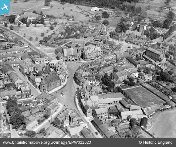
EPW021623 ENGLAND (1928). The town centre, Sandbach, 1928
© Copyright OpenStreetMap contributors and licensed by the OpenStreetMap Foundation. 2026. Cartography is licensed as CC BY-SA.
Nearby Images (5)
EPW021623

EPW021627

EPW021624

EPW021625

EPW021622

Details
| Title | [EPW021623] The town centre, Sandbach, 1928 |
| Reference | EPW021623 |
| Date | June-1928 |
| Link | |
| Place name | SANDBACH |
| Parish | SANDBACH |
| District | |
| Country | ENGLAND |
| Easting / Northing | 375756, 360851 |
| Longitude / Latitude | -2.3624980108306, 53.143961249429 |
| National Grid Reference | SJ758609 |
Pins
Be the first to add a comment to this image!
User Comment Contributions
Looking East, The Town Hall is in the middle, top-left is the triangular Scotch Common bordered by the odd tree. Bottom-left is the triangular-looking Highyown with the Literary Institute at its top-left. The tower of St Marys Church can just be seen top right, and the mill (now the antiques shop) is to the large building on the right. |

iantresman |
Tuesday 26th of June 2012 11:52:23 AM |