
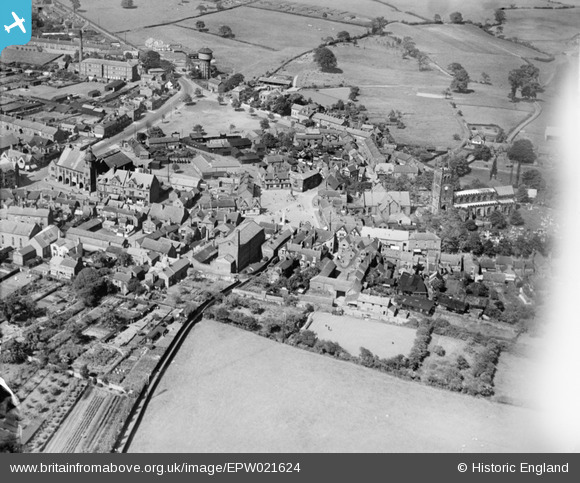
EPW021624 ENGLAND (1928). The Market Place and environs, Sandbach, 1928
© Copyright OpenStreetMap contributors and licensed by the OpenStreetMap Foundation. 2026. Cartography is licensed as CC BY-SA.
Nearby Images (5)
EPW021624

EPW021622

EPW021623

EPW021625

EPW021627

Details
| Title | [EPW021624] The Market Place and environs, Sandbach, 1928 |
| Reference | EPW021624 |
| Date | June-1928 |
| Link | |
| Place name | SANDBACH |
| Parish | SANDBACH |
| District | |
| Country | ENGLAND |
| Easting / Northing | 375851, 360782 |
| Longitude / Latitude | -2.361072392819, 53.143345266759 |
| National Grid Reference | SJ759608 |
Pins
Be the first to add a comment to this image!