
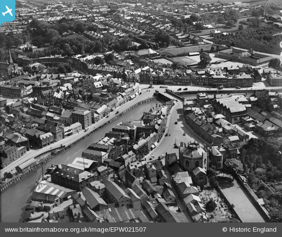
EPW021507 ENGLAND (1928). Wisbech Bridge and the Old Market, Wisbech, 1928
© Copyright OpenStreetMap contributors and licensed by the OpenStreetMap Foundation. 2026. Cartography is licensed as CC BY-SA.
Nearby Images (7)
EPW021507

EPW021500

EPW039188

EPW021503

EPW039184

EPW021501

EPW021504

Details
| Title | [EPW021507] Wisbech Bridge and the Old Market, Wisbech, 1928 |
| Reference | EPW021507 |
| Date | June-1928 |
| Link | |
| Place name | WISBECH |
| Parish | WISBECH |
| District | |
| Country | ENGLAND |
| Easting / Northing | 546047, 309682 |
| Longitude / Latitude | 0.15987625079265, 52.664803595099 |
| National Grid Reference | TF460097 |
Pins

Peter |
Friday 31st of January 2014 07:23:57 PM | |
|
Peter |
Sunday 26th of January 2014 08:34:40 AM | |
|
Peter |
Sunday 26th of January 2014 08:22:28 AM | |
|
Peter |
Tuesday 5th of February 2013 08:13:56 PM | |
|
Peter |
Tuesday 5th of February 2013 08:12:54 PM | |
|
Peter |
Tuesday 5th of February 2013 08:11:08 PM | |
|
Peter |
Friday 1st of February 2013 07:31:07 PM | |
|
Peter |
Friday 1st of February 2013 07:27:39 PM | |
|
Peter |
Friday 1st of February 2013 07:26:05 PM |