
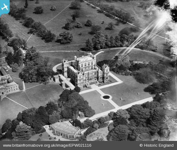
EPW021116 ENGLAND (1928). Wollaton Hall, Wollaton, 1928
© Copyright OpenStreetMap contributors and licensed by the OpenStreetMap Foundation. 2026. Cartography is licensed as CC BY-SA.
Nearby Images (4)
EPW021116

EPW021118

EPW019377

EPW021117

Details
| Title | [EPW021116] Wollaton Hall, Wollaton, 1928 |
| Reference | EPW021116 |
| Date | April-1928 |
| Link | |
| Place name | WOLLATON |
| Parish | |
| District | |
| Country | ENGLAND |
| Easting / Northing | 453211, 339235 |
| Longitude / Latitude | -1.2079884712484, 52.947543088165 |
| National Grid Reference | SK532392 |


