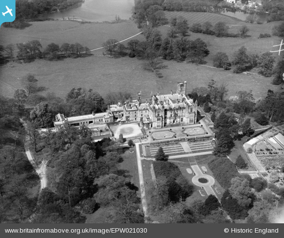
EPW021030 ENGLAND (1928). Merevale Hall and The Wilderness, Atherstone, 1928
© Copyright OpenStreetMap contributors and licensed by the OpenStreetMap Foundation. 2026. Cartography is licensed as CC BY-SA.
Details
| Title | [EPW021030] Merevale Hall and The Wilderness, Atherstone, 1928 |
| Reference | EPW021030 |
| Date | April-1928 |
| Link | |
| Place name | ATHERSTONE |
| Parish | MEREVALE |
| District | |
| Country | ENGLAND |
| Easting / Northing | 429540, 297345 |
| Longitude / Latitude | -1.5640769459704, 52.572764241603 |
| National Grid Reference | SP295973 |
Pins
Be the first to add a comment to this image!


![[EPW021030] Merevale Hall and The Wilderness, Atherstone, 1928](http://britainfromabove.org.uk/sites/all/libraries/aerofilms-images/public/100x100/EPW/021/EPW021030.jpg)
![[EAW012371] Merevale Hall, Merevale Hall, 1947. This image has been produced from a print.](http://britainfromabove.org.uk/sites/all/libraries/aerofilms-images/public/100x100/EAW/012/EAW012371.jpg)
![[EAW012372] Merevale Hall, Merevale Hall, 1947. This image has been produced from a damaged negative.](http://britainfromabove.org.uk/sites/all/libraries/aerofilms-images/public/100x100/EAW/012/EAW012372.jpg)