
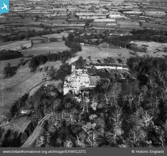
EAW012371 ENGLAND (1947). Merevale Hall, Merevale Hall, 1947. This image has been produced from a print.
© Copyright OpenStreetMap contributors and licensed by the OpenStreetMap Foundation. 2026. Cartography is licensed as CC BY-SA.
Nearby Images (3)
EAW012371

EAW012372

EPW021030

Details
| Title | [EAW012371] Merevale Hall, Merevale Hall, 1947. This image has been produced from a print. |
| Reference | EAW012371 |
| Date | 25-November-1947 |
| Link | |
| Place name | MEREVALE HALL |
| Parish | MEREVALE |
| District | |
| Country | ENGLAND |
| Easting / Northing | 429551, 297358 |
| Longitude / Latitude | -1.5639134640922, 52.572880521826 |
| National Grid Reference | SP296974 |
Pins

Matt Aldred edob.mattaldred.com |
Tuesday 1st of November 2022 04:59:11 PM |