
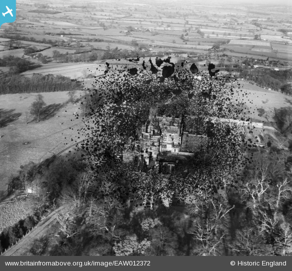
EAW012372 ENGLAND (1947). Merevale Hall, Merevale Hall, 1947. This image has been produced from a damaged negative.
© Copyright OpenStreetMap contributors and licensed by the OpenStreetMap Foundation. 2026. Cartography is licensed as CC BY-SA.
Nearby Images (3)
EAW012372

EAW012371

EPW021030

Details
| Title | [EAW012372] Merevale Hall, Merevale Hall, 1947. This image has been produced from a damaged negative. |
| Reference | EAW012372 |
| Date | 25-November-1947 |
| Link | |
| Place name | MEREVALE HALL |
| Parish | MEREVALE |
| District | |
| Country | ENGLAND |
| Easting / Northing | 429541, 297364 |
| Longitude / Latitude | -1.564060495284, 52.57293500879 |
| National Grid Reference | SP295974 |
Pins
Be the first to add a comment to this image!