
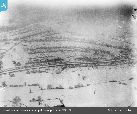
EPW020383 ENGLAND (1928). Housing in the snow around Folds Crescent, Beauchief, 1928
© Copyright OpenStreetMap contributors and licensed by the OpenStreetMap Foundation. 2026. Cartography is licensed as CC BY-SA.
Nearby Images (9)
EPW020383

EPW020404

EPW020384

EPW020385

EPW020399

EPW020381

EPW020403

EAW037100

EAW037099

Details
| Title | [EPW020383] Housing in the snow around Folds Crescent, Beauchief, 1928 |
| Reference | EPW020383 |
| Date | March-1928 |
| Link | |
| Place name | BEAUCHIEF |
| Parish | |
| District | |
| Country | ENGLAND |
| Easting / Northing | 433512, 382279 |
| Longitude / Latitude | -1.4966763895022, 53.336086043734 |
| National Grid Reference | SK335823 |
Pins
Be the first to add a comment to this image!