
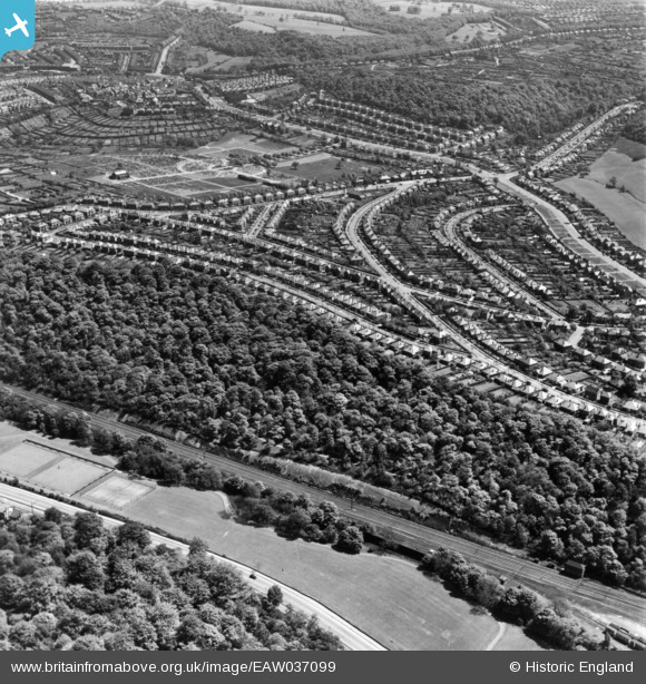
EAW037099 ENGLAND (1951). The residential area surrounding Dalewood Avenue and Dalewood Road, Sheffield, 1951. This image has been produced from a print.
© Copyright OpenStreetMap contributors and licensed by the OpenStreetMap Foundation. 2026. Cartography is licensed as CC BY-SA.
Nearby Images (9)
EAW037099

EAW037100

EPW020403

EAW037098

EPW020399

EAW037101

EPW020384

EPW020383

EPW020408

Details
| Title | [EAW037099] The residential area surrounding Dalewood Avenue and Dalewood Road, Sheffield, 1951. This image has been produced from a print. |
| Reference | EAW037099 |
| Date | 5-June-1951 |
| Link | |
| Place name | SHEFFIELD |
| Parish | |
| District | |
| Country | ENGLAND |
| Easting / Northing | 433282, 382486 |
| Longitude / Latitude | -1.5001089038232, 53.337961361976 |
| National Grid Reference | SK333825 |
Pins
Be the first to add a comment to this image!