
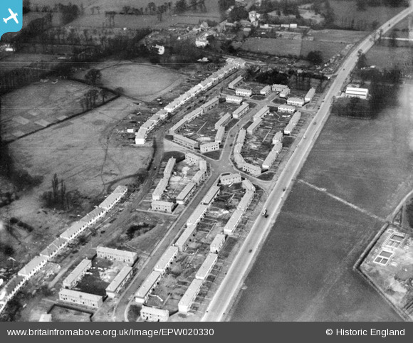
EPW020330 ENGLAND (1928). New housing at Stanhope Road, Greenford, 1928
© Copyright OpenStreetMap contributors and licensed by the OpenStreetMap Foundation. 2026. Cartography is licensed as CC BY-SA.
Nearby Images (14)
EPW020330

EPW020330
EPW056286

EPW020327

EPW020326

EPW020325

EPW056274

EPW020329

EPW020329
EPW020328

EPW056275

EPW020324

EPW056277

EPW056284

Details
| Title | [EPW020330] New housing at Stanhope Road, Greenford, 1928 |
| Reference | EPW020330 |
| Date | February-1928 |
| Link | |
| Place name | GREENFORD |
| Parish | |
| District | |
| Country | ENGLAND |
| Easting / Northing | 514270, 181976 |
| Longitude / Latitude | -0.35266283095222, 51.524642007377 |
| National Grid Reference | TQ143820 |
Pins

The Laird |
Thursday 28th of February 2019 03:01:05 PM | |
|
cbrndc |
Tuesday 16th of December 2014 09:40:17 AM | |
|
cbrndc |
Tuesday 16th of December 2014 09:39:50 AM | |
|
cbrndc |
Tuesday 16th of December 2014 09:39:04 AM | |
|
cbrndc |
Tuesday 16th of December 2014 09:38:40 AM | |
|
cbrndc |
Tuesday 16th of December 2014 09:37:09 AM | |
|
cbrndc |
Tuesday 16th of December 2014 09:36:36 AM | |
|
headpin |
Monday 6th of October 2014 10:08:06 AM | |
|
headpin |
Monday 6th of October 2014 10:07:33 AM |