
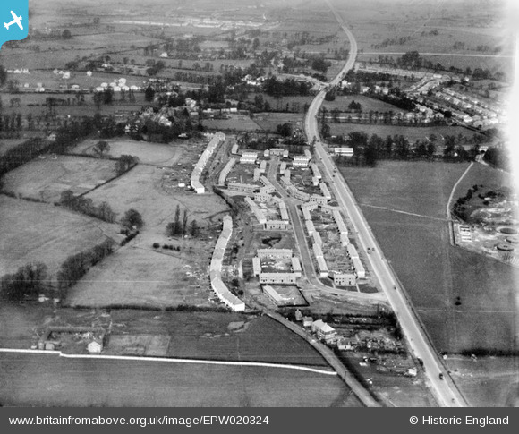
EPW020324 ENGLAND (1928). New housing at Stanhope Road, Greenford, from the south-west, 1928
© Copyright OpenStreetMap contributors and licensed by the OpenStreetMap Foundation. 2026. Cartography is licensed as CC BY-SA.
Nearby Images (8)
EPW020324

EPW020329

EPW020329
EPW020325

EPW020326

EPW020327

EPW020330

EPW020330
Details
| Title | [EPW020324] New housing at Stanhope Road, Greenford, from the south-west, 1928 |
| Reference | EPW020324 |
| Date | February-1928 |
| Link | |
| Place name | GREENFORD |
| Parish | |
| District | |
| Country | ENGLAND |
| Easting / Northing | 514205, 181771 |
| Longitude / Latitude | -0.35366593467972, 51.52281246376 |
| National Grid Reference | TQ142818 |
Pins

GaryW |
Thursday 24th of March 2022 02:29:10 PM | |

Des Elmes |
Thursday 14th of April 2016 04:46:04 PM | |
|
Des Elmes |
Tuesday 5th of April 2016 01:24:02 AM | |
|
Des Elmes |
Tuesday 5th of April 2016 01:20:59 AM | |
|
Des Elmes |
Tuesday 5th of April 2016 01:20:37 AM |