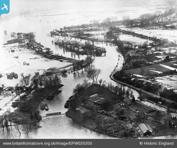
EPW020200 ENGLAND (1928). Flooding around Pharaoh's Island and Shepperton Lock, Shepperton, 1928
© Copyright OpenStreetMap contributors and licensed by the OpenStreetMap Foundation. 2025. Cartography is licensed as CC BY-SA.
Nearby Images (5)
Details
| Title | [EPW020200] Flooding around Pharaoh's Island and Shepperton Lock, Shepperton, 1928 |
| Reference | EPW020200 |
| Date | 3-January-1928 |
| Link | |
| Place name | SHEPPERTON |
| Parish | |
| District | |
| Country | ENGLAND |
| Easting / Northing | 507175, 165868 |
| Longitude / Latitude | -0.45978591106195, 51.381233475784 |
| National Grid Reference | TQ072659 |
Pins
Be the first to add a comment to this image!


![[EPW020200] Flooding around Pharaoh's Island and Shepperton Lock, Shepperton, 1928](http://britainfromabove.org.uk/sites/all/libraries/aerofilms-images/public/100x100/EPW/020/EPW020200.jpg)
![[EPW001525] Pharaoh's Island, Hamhaugh Island and environs, Hamm Moor, 1920. This image has been produced from a copy-negative.](http://britainfromabove.org.uk/sites/all/libraries/aerofilms-images/public/100x100/EPW/001/EPW001525.jpg)
![[EPW020202] Flooding around Pharaoh's Island and Shepperton Lock, Shepperton, 1928](http://britainfromabove.org.uk/sites/all/libraries/aerofilms-images/public/100x100/EPW/020/EPW020202.jpg)